Drone Real Estate Photography in the West Island (2026)
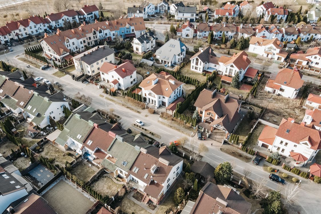
Fly a drone above Baie-d'Urfé or Senneville and the West Island explains itself in a single frame: Lac Saint-Louis and Lac des Deux Montagnes wrapping the peninsula on two sides, mature tree canopy over Beaconsfield and Pointe-Claire, golf fairways threading between streets, and a shoreline that a ground-level camera can only ever describe secondhand. For a region where waterfront access, lot size and proximity to the water are often the actual selling point, an aerial shot isn't decoration. It's the one photo that shows what a buyer is really paying for.
That raises a practical question for West Island sellers and agents: when does a drone add-on actually earn its cost, what does Transport Canada require of whoever flies it, and how does flying near Montréal–Trudeau International Airport change the picture? Here's the plain-language answer for this specific market.
Key Takeaways
- As of March 31, 2026, Canada had 118,232 registered drones and 20,982 Advanced Pilot Certificate holders — the certification level required for most real estate shoots near homes and bystanders — up from 116,304 and 20,138 respectively three months earlier (Transport Canada, Drone Zone Issue 6, April 2026, comparing to Drone Zone Issue 5, December 2025).
- The Montreal CMA logged 5,045 residential transactions in March 2026, up 2% year over year, with the single-family segment hitting a new median price record of $639,000 and the market sitting at 4.8 months of inventory (APCIQ, March 2026 Montreal CMA report).
- 52% of REALTORS® reported using drone photography or video in their business, the third most-used technology behind eSignature (79%) and social media (75%) — a U.S. figure from a July 2025 survey, not Quebec-specific data, but a useful signal of how mainstream aerial imagery has become in the profession (National Association of REALTORS®, 2025 REALTORS® Technology Survey).
- Part of the West Island sits inside controlled airspace around Montréal–Trudeau International Airport (YUL), which means a compliant drone flight there needs airspace authorization before takeoff, not just a certificate.
- Not every West Island listing needs an aerial add-on — the properties where it pays off are fairly specific, covered below.
Why the West Island's Geography Rewards Aerial Photography
The West Island isn't one uniform suburb — it's a string of distinct municipalities, Baie-D'Urfé, Beaconsfield, Dollard-des-Ormeaux, Dorval, Kirkland, Pointe-Claire, Sainte-Anne-de-Bellevue and Senneville, plus the boroughs of L'Île-Bizard–Sainte-Geneviève and Pierrefonds-Roxboro, each with its own relationship to the water. Waterfront addresses in Pointe-Claire, Beaconsfield and Baie-d'Urfé, and the larger estate lots that define Senneville, are consistently the region's most sought-after properties — the same water-and-acreage logic that makes drone photography pay off further west in Vaudreuil-Soulanges, just applied to a denser, more established shoreline. A ground-level photo of a waterfront home shows the house. An aerial shot shows the water, the dock, the neighbouring shoreline and how much of the lot actually touches it — the exact information a buyer needs to justify the premium that comes with a water address.
The same logic applies away from the shoreline. Streets in Beaconsfield and Pointe-Claire back onto Golf Dorval and other course-adjacent greenspace, and an overhead shot is the only practical way to show a buyer how close a backyard actually sits to a fairway without them driving over to check. Newer construction and larger lots on the western edge of the region, toward Sainte-Anne-de-Bellevue, benefit the same way: buyers comparing several similarly priced listings decide quickly which one earns a showing, and a flat street-level photo set competing against a listing with a strong aerial hero shot is already starting from behind.
What an Aerial Shot List Actually Covers
A useful drone session isn't a single dramatic photo — it's a short, deliberate shot list built around the questions West Island buyers actually ask:
- The elevated hero shot: the front of the home from roughly 20–30 feet up, level and clean, usually the strongest single image in the whole gallery
- The lot boundary view: a straight-down shot answering "how big is this yard, really" — fence lines, pool, garden beds and all
- The water or golf-course relationship: for waterfront and course-adjacent homes, the shot that shows exactly how close the lot sits to what makes it valuable
- The street and neighbourhood context: tree canopy, the block, nearby parks or the Lakeshore, the things a buyer is really moving to the West Island for
- A short orbit clip: a slow rotation around the property that works as both a standalone video and raw footage for social content
Ground photography documents rooms. Aerial photography answers the "how does this property actually sit on its lot" question before a buyer ever books a showing. For the ground-level side of that equation, ranging from interior prep to what a full listing photography package costs in this market, see our Real Estate Photography in the West Island (2026) guide.
Transport Canada Rules: What Changes the Moment a Drone Is for Sale
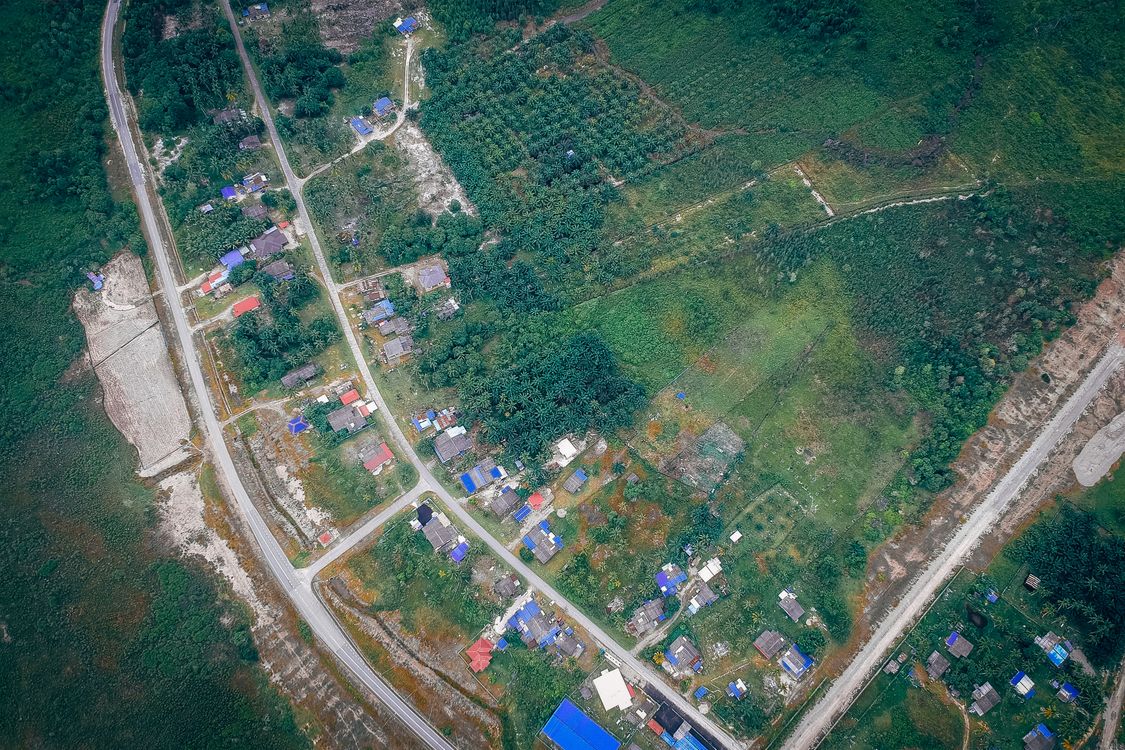
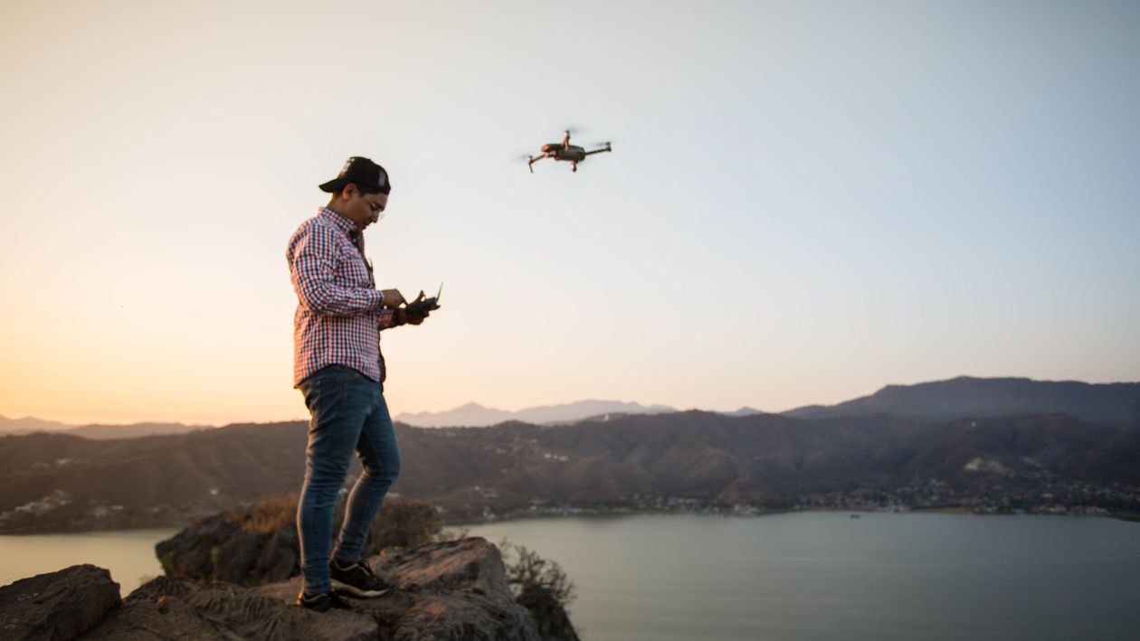
The moment a drone flies to help market a property, it's a commercial operation under Canadian aviation law, not a hobby flight, and the recreational rules that apply to a backyard drone don't apply here. A compliant operator needs a Transport Canada pilot certificate, and for almost any West Island shoot, that means the Advanced certificate specifically. Basic-certificate pilots are restricted to uncontrolled airspace at least 30 metres from bystanders, a condition that real estate work in a dense residential neighbourhood essentially never meets. On top of the certificate, a legitimate operator also needs a registered drone with its registration number displayed on the aircraft, a documented site survey completed before the flight, and liability insurance, which most brokerages now ask to see before anyone flies over a listing.
Certification in Canada has been growing steadily. Transport Canada's own Drone Zone newsletter shows 118,232 registered drones and 20,982 Advanced Pilot Certificate holders as of March 31, 2026, up from 116,304 and 20,138 respectively at the end of December 2025 — growth concentrated disproportionately in the Advanced category, the one that actually matters for real estate work near people and buildings.
Flying Near YUL: The Controlled Airspace Question Most Guides Skip
This is where the West Island differs from almost anywhere else Group PV Media shoots. Montréal–Trudeau International Airport (YUL) sits in Dorval, inside the West Island itself, which means a meaningful share of the region, not just the airport property, falls under controlled airspace. A drone operator can't simply show up and fly because a homeowner said yes. Controlled airspace near an active airport requires authorization through NAV CANADA before takeoff, checked against Transport Canada's site-specific airspace data for that exact address, in addition to holding an Advanced Pilot Certificate and a documented site survey.
In practice, this means a West Island shoot needs an extra planning step that a listing in a less air-traffic-dense part of Quebec doesn't: confirming the property's airspace classification and, where required, securing authorization before the flight is booked, not the morning of. A homeowner who hires "a friend with a drone" for a Beaconsfield or Dorval listing is taking on real regulatory exposure without realizing it; a legitimate operator should be able to explain, specifically, how they've cleared the airspace for that address before they ever fly.
When an Aerial Add-On Is Worth It for a West Island Listing
Not every West Island property needs a drone add-on, and a straightforward answer to when it pays off is worth more than a blanket recommendation:
- Waterfront and near-waterfront homes in Baie-d'Urfé, Beaconsfield, Pointe-Claire and Sainte-Anne-de-Bellevue — the water access is often the actual reason for the price, and it's the one thing a ground photo can't fully show
- Large estate lots, especially in Senneville, where the land itself is a meaningful part of the value
- Golf-course-adjacent properties in Beaconsfield and Pointe-Claire, where proximity to the fairway is a selling point worth showing clearly
- New construction or larger newer homes on bigger lots toward Sainte-Anne-de-Bellevue, where the surrounding streetscape is still part of the pitch
It matters less for a standard townhouse or a modest lot in the denser parts of Dollard-des-Ormeaux, Kirkland or Pierrefonds-Roxboro, where an aerial shot mostly repeats what a good exterior ground photo already shows. As in the region's photography market generally, drone and video add-ons here typically run in the $150–$400 range on top of a base listing photography package, though the exact quote depends on property size, site-survey complexity and how far the address sits inside controlled airspace. A related question, whether twilight or video coverage makes more sense than drone for a specific property, is covered in our Real Estate Video Tours in the West Island guide.
How the Shoot Actually Works
From a seller's side, the process should be straightforward: the operator reviews the address and its airspace classification before confirming a booking, flies only in acceptable weather (wind, rain and low cloud all ground a shoot rather than deliver grey, shaky footage), completes the aerial and ground sessions together in a single visit where possible, and delivers edited images and clips typically within 48 to 72 hours, ready for Centris, MLS listings and social media. The same aerial footage doubles as raw material for a short social clip promoting the listing, which fits into a broader video marketing plan for West Island businesses rather than being a one-off asset. Drone photography isn't limited to residential listings either — the same certification and airspace process applies to commercial and industrial sites in the region, covered in more detail in our drone roof inspection guide for Quebec properties.
Frequently Asked Questions
Is drone photography legal for real estate in the West Island?
Yes, but only when flown by a pilot holding a Transport Canada certificate, almost always the Advanced certificate for residential West Island work, with a registered drone, a completed site survey, and airspace authorization where the property falls under controlled airspace near YUL.
Why does the West Island need extra drone authorization compared to other areas?
Montréal–Trudeau International Airport (YUL) is located in Dorval, inside the West Island, so a meaningful portion of the region sits under controlled airspace. Flying there requires clearing that airspace through NAV CANADA in addition to holding the right pilot certificate, a step that doesn't apply the same way in less air-traffic-dense parts of Quebec.
How much does drone photography cost for a West Island listing?
In this market, a drone add-on typically runs $150 to $400 on top of a base real estate photography package, with the exact price depending on property size and the complexity of the required site survey and airspace clearance.
Does every West Island listing need drone photos?
No. It pays off most for waterfront and near-waterfront homes, large estate lots, golf-course-adjacent properties, and newer larger builds. A standard townhouse or a modest lot in the denser parts of the region usually doesn't need one.
How common is drone photography among real estate agents?
In a July 2025 U.S. survey, 52% of REALTORS® reported using drone photography or video, the third most-used technology among members. That's U.S.-wide data, not a Quebec figure, but it reflects how mainstream aerial imagery has become in the profession generally.
Conclusion
Aerial photography earns its cost on the West Island when a property's value depends on something a ground-level camera can't show: water access, a large lot, proximity to a fairway, or the surrounding streetscape of a larger newer build. Getting it right here also means one extra step most guides skip: clearing the property's airspace near YUL before the flight, not after. Sellers and agents evaluating whether a specific West Island listing needs the add-on can request a quote for your property rather than guessing from a generic checklist.
Considering aerial photos for a West Island listing? Group PV Media flies Transport Canada Advanced-certified, fully insured drone shoots across Baie-d'Urfé, Beaconsfield, Pointe-Claire, Kirkland, Dollard-des-Ormeaux, Dorval, Senneville and Sainte-Anne-de-Bellevue, with airspace clearance handled before we ever show up. Send us the address and we'll confirm the airspace, quote the flight, and pair it with professional listing photography in a single visit.
About the author
Pranshu Verma is the founder of Group PV Media, a photography, drone, and video production company serving real estate agents and sellers across Vaudreuil-Soulanges, the West Island, Saint-Lazare, Montreal, and Laval, Quebec.
Want to apply this to your business?
Book a free 30-minute call. We’ll look at your situation together and you’ll leave with a clear plan — no commitment.
Book a free consultation